How Drone Technology Moved From Military Surveillance To Commercial Use
The Evolution of Drone Technology
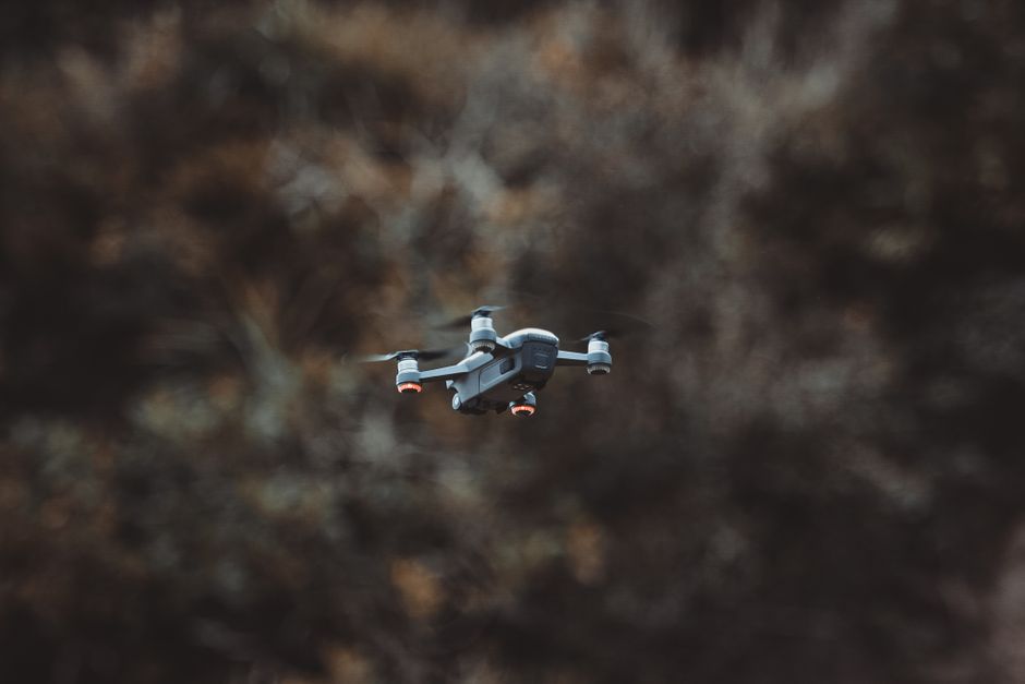
The sight of a small aircraft buzzing overhead, capturing high-definition aerial footage, has become remarkably common. What once seemed like a scene straight out of a science fiction movie is now a daily reality, driven by rapid advancements in drone technology. This shift wasn't sudden, but rather a methodical evolution of machinery initially designed for stealth, reconnaissance, and military strategic dominance.
For decades, unmanned aerial vehicles were exclusive tools for intelligence agencies and defense contractors. They were cumbersome, expensive, and required massive infrastructure to operate effectively in the field. Today, the democratization of these systems allows hobbyists, business owners, and researchers to leverage sophisticated flight platforms for diverse commercial applications.
From Battlefield Skies to Backyard Gadgets
The transition from military dominance to commercial accessibility required a complete overhaul of how we perceive flight control. Early military models relied on complex, satellite-linked navigation and heavily guarded proprietary software. As miniaturization progressed, the essential components—flight controllers, GPS modules, and lithium-polymer batteries—became both cheaper and more efficient.
Engineers managed to pack immense processing power into small, lightweight airframes that could be piloted via smartphone or tablet. This shift allowed developers to focus on consumer-friendly interfaces, moving away from specialized military training. Consequently, the industry exploded, turning complex machines into intuitive tools for photographers and casual pilots alike.

The Shrinking Sensor Advantage
Beyond the flight mechanics, the development of lightweight, high-resolution sensors was the true catalyst for commercial success. Initially, military drones carried bulky, mission-specific surveillance equipment that offered little utility for civilian markets. As digital cameras and sensors shrank in size, they gained significantly better imaging capabilities.
Modern commercial platforms now boast impressive features that were unimaginable just fifteen years ago. These include:
- Thermal imaging cameras for search and rescue operations.
- LiDAR scanning for precise 3D mapping and topography.
- Multispectral sensors used to analyze soil health and vegetation.
- High-frame-rate 4K video recording for professional cinematography.
Revolutionizing Agriculture and Precision Farming
Agriculture represents perhaps the most impactful shift for commercial aerial platforms. Farmers have moved away from manual crop monitoring toward highly automated processes powered by aerial data. By utilizing specialized sensors, operators can now identify plant stress, water needs, and nutrient deficiencies long before they are visible to the naked eye.
This level of precision farming minimizes the need for excess fertilizer and pesticides, ultimately reducing operational costs and environmental impact. Automated flight patterns allow for complete field coverage in a fraction of the time it would take a human to walk the same rows. This data-driven approach is reshaping global food production by maximizing yields through intelligent aerial oversight.

Transforming Construction and Urban Planning
The construction industry relies heavily on project timelines and accurate site surveys, making it a prime candidate for aerial intervention. Traditional land surveying is a time-consuming, expensive process prone to human error. With drone usage, site managers can capture massive amounts of data in hours rather than days.
Engineers now generate high-resolution digital twins of active construction sites to monitor progress and detect deviations from original blueprints. This capability prevents costly mistakes and ensures that large-scale infrastructure projects remain on schedule. Aerial surveys also provide safe inspection methods for hard-to-reach areas, such as roofs, bridges, or industrial chimneys.
The Logistics and Delivery Frontier
One of the most ambitious frontiers for these platforms is the promise of autonomous delivery. While regulatory frameworks are still maturing, the potential to bypass ground-based traffic congestion is undeniable. Companies are testing systems that can drop small parcels directly to a residential doorstep with extreme precision.
Beyond convenience, this tech offers critical benefits for urgent medical logistics. In remote areas, aerial vehicles can transport blood samples, organs, or vaccines across terrain that would be impossible for a standard courier vehicle to traverse. These capabilities bridge gaps in healthcare infrastructure and demonstrate the potential for life-saving logistical solutions.
Safety and Regulatory Hurdles
Integrating these systems into shared, populated airspace requires significant collaboration between aviation authorities and private operators. As the number of craft increases, the risk of mid-air collisions becomes a pressing concern for civil aviation. Regulatory bodies have implemented strict flight zones, altitude limits, and mandatory registration to maintain a safe environment.
The path forward relies on the implementation of advanced traffic management systems. These digital networks are being designed to communicate with drones automatically, ensuring safe separation distances and adherence to local restrictions. Balancing technological freedom with public safety is the primary challenge for the industry to achieve long-term growth.
The Future of Aerial Intelligence
The rapid transformation of aerial platforms suggests that we are only scratching the surface of their potential capabilities. Future developments will likely focus on longer flight times, increased autonomy through artificial intelligence, and more seamless data integration. The ability for these platforms to perform complex tasks without direct human supervision will unlock new possibilities in infrastructure maintenance and emergency management.
We are witnessing a fundamental change in how we monitor, survey, and interact with the physical world from an aerial perspective. What started as a specialized military tool has become a foundation for commercial innovation across dozens of industries. The continued integration of intelligent aerial tools will undoubtedly define the next decade of operational efficiency and data collection.