How Gps Technology Went From Military Use To Everyday Navigation
The Evolution of GPS Technology: From Military Secret to Everyday Essential
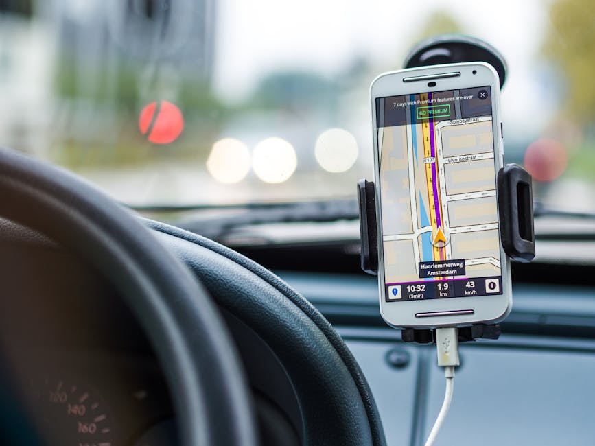
Have you ever stopped to wonder how your phone magically knows your exact location within a few meters? Whether you are navigating to a new coffee shop or tracking your morning run, you are relying on a massive, complex network circling high above the earth. This is the power of GPS technology, a tool that has silently woven itself into the fabric of our daily routines.
What was once a strictly controlled government secret has transformed into the backbone of modern convenience. It is hard to imagine a time when we had to fumble with paper maps just to find our way across town.
The Cold War Origins of Satellite Navigation
The story begins during the height of the Cold War when the United States military faced a significant challenge. They needed a way to pinpoint the precise location of ships, aircraft, and missiles in real-time, regardless of the weather conditions. Ground-based navigation systems simply could not provide the required accuracy or reliability across the entire globe.
In the 1970s, the Department of Defense began launching a constellation of satellites designed to solve this specific problem. These satellites sent out signals that receivers on the ground could use to calculate their exact position through a process called trilateration. It was a groundbreaking achievement designed to give the military a massive tactical advantage.

How GPS Technology Actually Works
At its core, the system relies on a network of over 30 satellites currently in orbit. Each satellite continuously broadcasts its position and the exact time of transmission. A receiver in your smartphone or car listens for these signals from at least four different satellites at once.
By comparing the time it took for each signal to arrive, the device calculates its distance from those specific satellites. Once the distance from enough satellites is known, the device can pinpoint its location in three-dimensional space. The precision is truly remarkable, allowing for navigation down to just a few feet.
The Turning Point: Making Positioning Data Accessible
For years, this capability remained firmly in the hands of the military, with signal accuracy artificially degraded to prevent unauthorized use. However, a tragic event in 1983 changed everything when a commercial airliner, Korean Air Lines Flight 007, was shot down after mistakenly straying into restricted Soviet airspace. The disaster highlighted the urgent need for better navigation for civilian aviation.
Following this incident, President Ronald Reagan announced that the system would eventually be made available for civilian use. It was a massive shift in philosophy that recognized the potential benefits for global safety and commerce.
This critical decision paved the way for the eventual widespread adoption of the network we know today. It allowed for innovation to flourish outside of government-controlled military projects.

From Military Asset to Smartphone Necessity
The transition from a military tool to a smartphone staple did not happen overnight. In the early days, civilian receivers were bulky, expensive, and limited in functionality. They were primarily used by professionals in fields like surveying, aviation, and maritime navigation who could justify the cost.
As technology advanced, the receivers became smaller, cheaper, and faster. The real shift occurred when smartphones integrated these chips directly, putting powerful navigation tools into the pockets of billions.
Beyond Maps: Surprising Ways We Rely on Positioning
While navigation is the most visible use of this system, its impact extends far beyond getting you from point A to point B. The time-sync signals sent by the satellites are used to coordinate everything from global banking transactions to power grid management. It acts as an invisible, highly accurate clock that keeps the modern world synchronized.
You might be surprised by the industries that rely on this constant stream of data:
- Precision Agriculture: Farmers use it to guide autonomous tractors and monitor crop health across massive fields.
- Logistics: Shipping companies track packages in real-time to optimize delivery routes and reduce fuel consumption.
- Emergency Services: Responders use precise positioning to find accident locations rapidly, even in rural areas.
- Financial Markets: High-frequency trading relies on microsecond-accurate time stamps provided by the satellite network.
The Future of Precise Global Positioning
The system continues to evolve as new satellites are launched with more powerful transmitters and better signal interference resistance. These upgrades are crucial for new applications like autonomous vehicles, which require a higher degree of accuracy than a typical navigation app.
We are also seeing the integration of multi-constellation support, where devices use signals from European, Russian, and Chinese systems alongside American satellites. This increased access improves reliability in challenging environments like urban canyons where tall buildings block satellite views.