How Remote Sensing From War Planes Changed Agricultural Management
Warfare has historically been an unlikely catalyst for agricultural advancement. When early pilots began capturing aerial photographs of enemy positions, they inadvertently laid the foundation for modern precision farming through remote sensing from war planes.
This transformation, while surprising to many, has fundamentally altered how farmers monitor their fields and make critical management decisions. By moving from ground-level observations to an aerial perspective, the industry has embraced new tools that were originally developed for entirely different purposes.
The Tactical Shift from Battlefield to Farm
Military leaders originally utilized aerial reconnaissance to spot camouflaged assets on the ground. By analyzing shadows and textures from high altitudes, they gained a significant tactical advantage over their adversaries. This intelligence-gathering approach required high-resolution imaging that could penetrate obstacles, turning the battlefield into a chessboard of data.
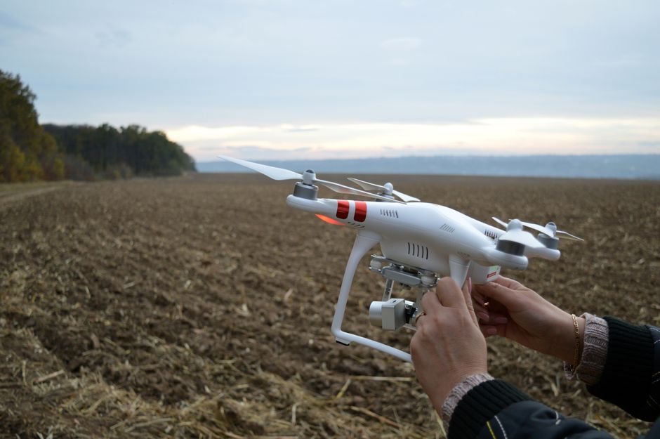
This same logic now applies to modern agriculture, where field monitoring is akin to strategic surveillance. Farmers no longer rely solely on ground-level observations to assess the health of their crops. Instead, they look down from above, capturing the same kind of intelligence that once helped commanders win wars.
How Military Technology Became a Farmer's Tool
The transition from reconnaissance technology to agricultural tool required a shift in how we interpret light. Military cameras were originally designed to detect differences between natural vegetation and man-made structures, which were often hidden by camouflage. These multispectral sensors, capable of capturing wavelengths beyond human vision, proved remarkably effective at distinguishing subtle differences in leaf health.
Farmers quickly realized that these sensors could identify crop stress caused by water shortages, nutrient deficiencies, or pests before any visible signs appeared to the naked eye. What was once used to spot a hidden bunker now helps reveal a patch of dry soil or a developing infection in a wheat field. The technology effectively democratized access to high-level field intelligence.

The Benefits of Remote Sensing from War Planes
Implementing remote sensing from war planes technology has provided farmers with an unprecedented ability to act proactively rather than reactively. Early detection allows for targeted interventions, saving both time and money. Growers can now pinpoint specific zones that require attention instead of treating an entire field uniformly.
The efficiency gained through this technology is substantial. By focusing efforts on areas that truly need help, farmers drastically reduce input waste and improve overall yields. The data provides a clear map of field conditions, ensuring that every drop of water and unit of fertilizer is utilized optimally.
Unlocking Multispectral Imaging Power
Multispectral imaging remains the backbone of this agricultural revolution. It captures various bands of light, particularly infrared, which is highly reflective for healthy plants. When crops are stressed, their ability to reflect this light changes, making the issue immediately apparent in processed imagery.
Several distinct advantages arise from utilizing this type of imaging:
- Early detection of plant disease before symptoms manifest visually.
- Accurate monitoring of crop water requirements across diverse soil types.
- Precise assessment of nutrient distribution to guide fertilizer application.
- Tracking of weed encroachment to minimize chemical usage.
Precision Resource Management
Precision agriculture relies heavily on the data extracted from these aerial images. By creating detailed application maps, farmers can automate their equipment to vary input rates across a single field. This level of granularity ensures that resources are distributed according to actual plant needs, not historical assumptions or guesswork.
This technological leap bridges the gap between massive-scale farming and the meticulous care usually found in small garden plots. Farmers can now manage thousands of acres with a precision that was once physically impossible. The result is a more resilient and profitable operation that adapts quickly to changing environmental factors.
Sustainability and Environmental Stewardship
The environmental benefits of adopting these technologies are equally significant. Reducing the excessive application of chemicals and water directly impacts local ecosystems by decreasing runoff and preserving soil health. Farmers are not just improving their bottom line; they are also becoming better stewards of the land.
Sustainability in agriculture often hinges on how effectively we can minimize our footprint while maximizing output. By utilizing the insights gained from historical reconnaissance techniques, modern farming becomes more efficient and less resource-intensive. This approach ensures that agricultural land remains productive for future generations.

Embracing the Aerial Perspective
The future of agricultural management is intrinsically linked to our ability to interpret data from above. As artificial intelligence and machine learning continue to integrate with aerial imagery, the speed and accuracy of these insights will only improve. We are moving toward a fully autonomous system where fields are monitored and managed with minimal human intervention.
Farmers who embrace this aerial perspective are positioning themselves at the forefront of a major shift in food production. The journey from the battlefield to the farm has been long, but the impact is undeniable. Aerial technology has redefined what it means to manage land effectively in a rapidly changing world.